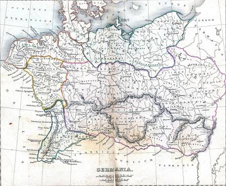
Who knew there were three Bosphurus’s (or Bosphuri ?) to the Ancient Greeks? How many Alexandrias did Alexander the Great found? Does not the name Dura Europa convey a the thought of a city on the edge of empire?
Here are two links that help with ancient geography. How fortunate we are to live in an age where data is easy to get and store!
1. Maps: http://ancienthistory.about.com/od/maps/ig/Ancient-World–Maps/
2. Place Names: http://ancienthistory.about.com/sitesearch.htm?q=ancient+place+names&SUName=ancienthistory
The map above was probably made in Germany during the reign of Kaiser Wilhelm II and reflects his triple personality. As Kaiser (Caesar) he wanted to unite Europe under his rule. He also represented the German tribes that had replaced the Western Empire. And, if you look at this map via the link, you will see that the eastern border of Germania Magna is on the Vistula River, deep into Polish territory; the traditional eastern border is the Oder River. A harbinger of the the Kaiser’s desire to expand his territory.
Look at the Danube. Just east of Castra Regina (modern Regensburg) is a south Flowing river, the modern Naab. In Regensburg is a gate called the Porta Praetoria. I think it was a sally port or postern gate but my German friends insisted that from time to time the Romans would sally forth and travel up the Naab valley as far north as modern Hohenfels to pacify some fractious Germans.

Leave a comment